Can I do quick differences with indices in Maps?
DE Africa Map (https://maps.digitalearth.africa/) is an interactive interface that allows you to view and compare the different datasets available on the platform. But you can also create difference with indices - in the GeoMAD, currently - to better appreciate changes between the different dates.
To do so, load the Sentinel-2 annual GeoMAD Service in your view by following this tutorial.
Then click on the three vertical dots on you maps in the workbench.
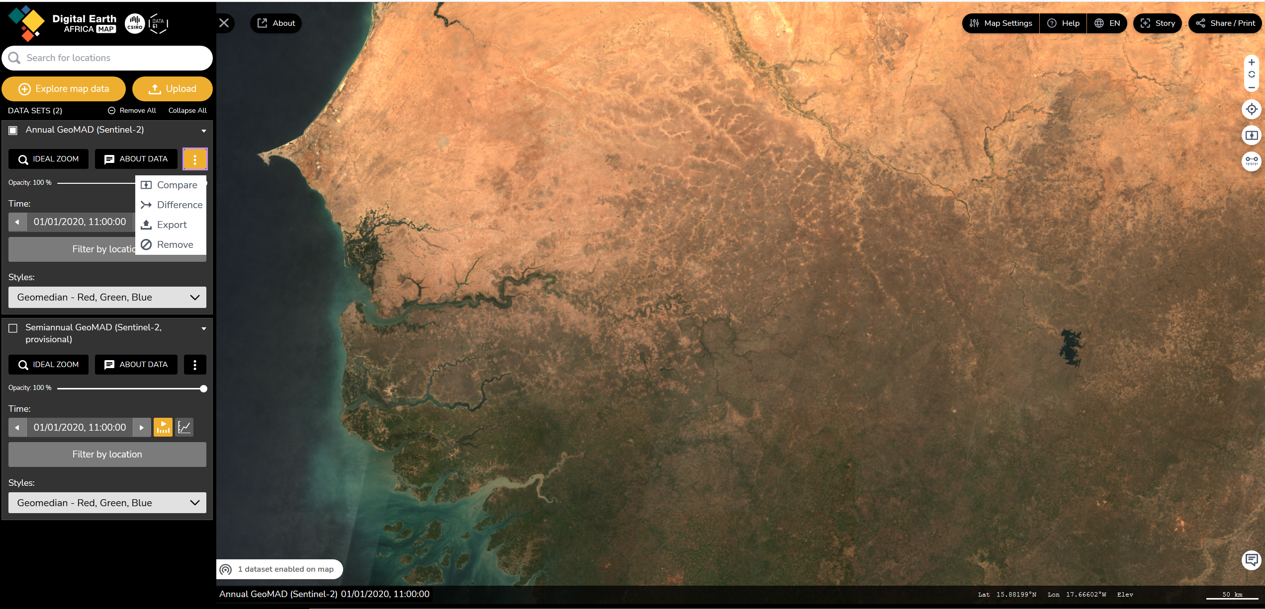
Then click on "Difference". then chose two different dates on each side of the cursor.
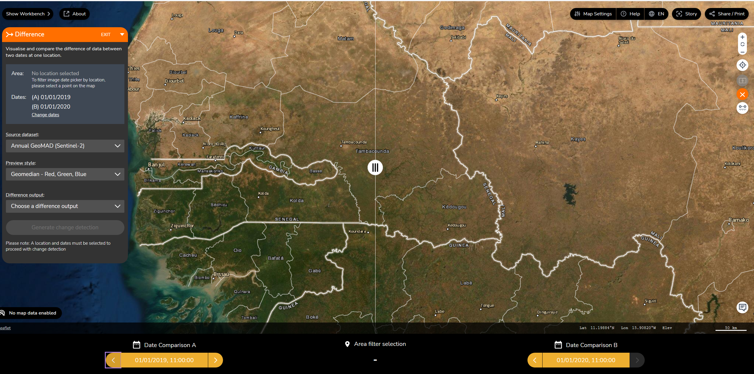
then select a location by clicking on the map.
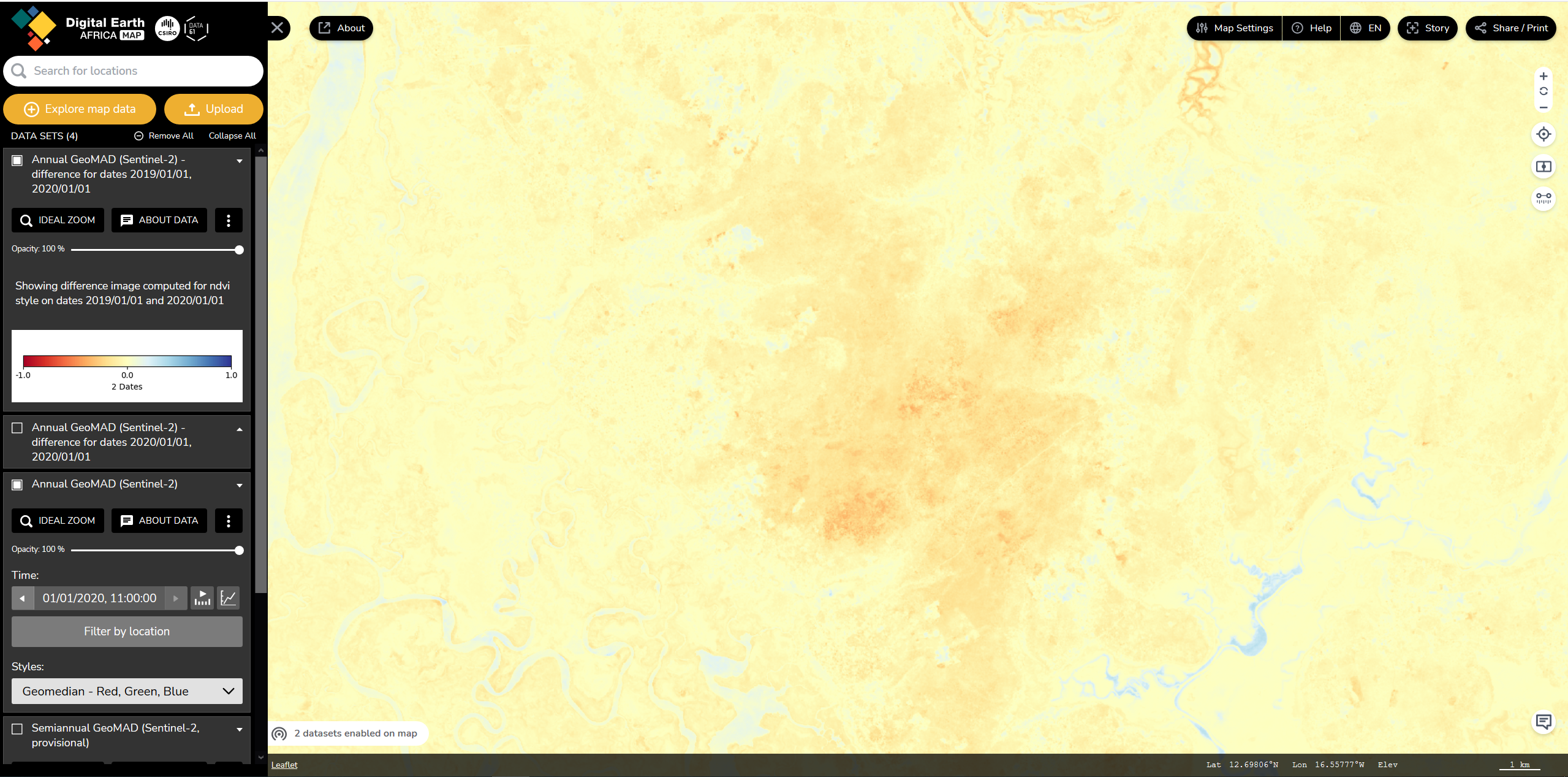
Select the desired indice on which you want to make the difference. and click on "generate the output"
Topic Participants
cedric tester